The City of Houston is holding meetings to receive public input about redistricting and share information about Capital Improvement Projects. The District H Town Hall will take place in person at Moody Park Recreation Center, as well as virtually on Microsoft Teams.
When: Mon, Apr 25th, 6pm
Where: Moody Park Community Center, 3725 Fulton -OR- Virtual
Details can be found on the Planning and Development Department’s website and in this committee presentation. Please view page 9 of the presentation to see what the 2020 Census determined current populations of Council Districts to be, and why District H will need boundary adjustments to come into compliance. Please note that the public is invited to attend any Town Hall Meeting, not just those within their Council District.
Infrastructure
Support Local Businesses /
North Street Safety Improvements April Meeting /
Houston Public Works will make a brief presentation on the North Main Bike Lane Extension, which will run from West Cottage to Airline at the WHCA member meeting. Join us Tuesday, April 12, 6-7pm, at Norhill Esplanade.
11th Street Safety improvements /
The WHCA recently submitted this letter of support for 11th Street Safety Improvements.
Let’s Talk Houston!
www.LetsTalkHouston.org/11th-street-bikeway
Houston Bikeways Program
www.houstonbikeplan.org | 832-395-2700 | bikeways@houstontx.gov
Houston Vision Zero
Citywide safe streets effort to end traffic deaths and serious injuries. Provide feedback about traffic safety concerns in your neighborhood. www.visionzerohouston.com
Director of Infrastructure | Brad snead
Email infrastructure@woodland-heights.org or complete the form below to contact.
Infrastructure Corner /
11th Street Bikeway
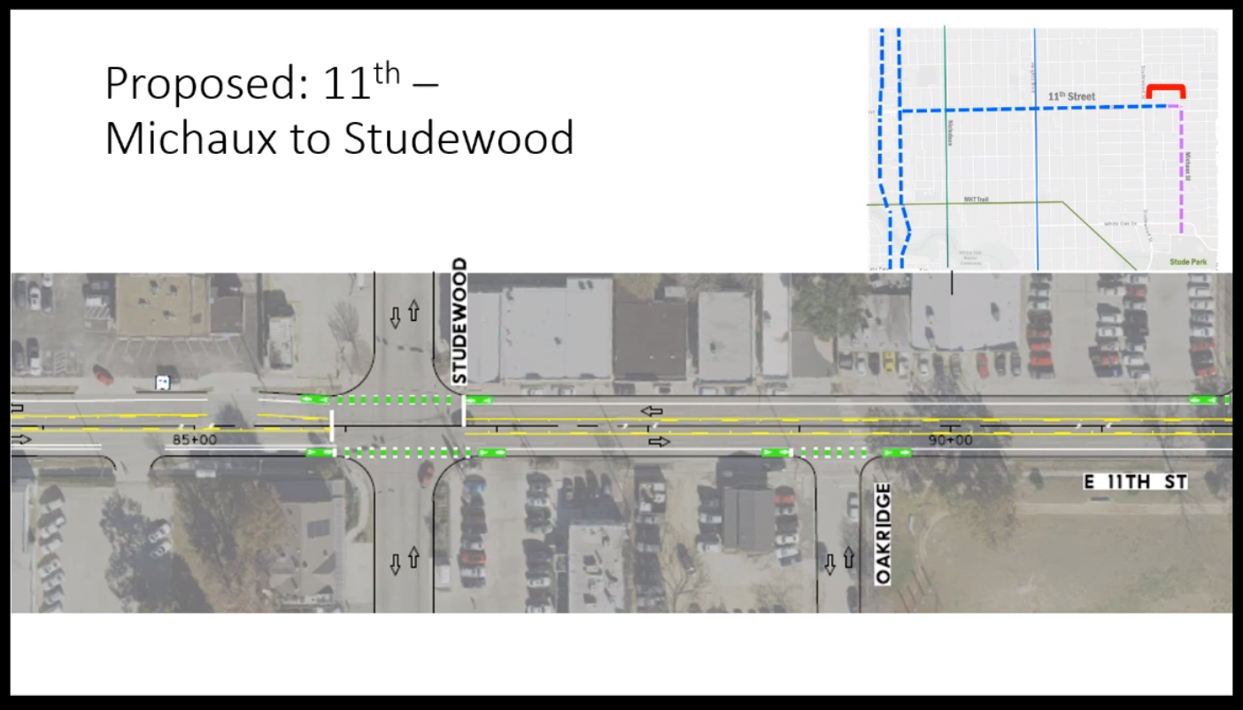
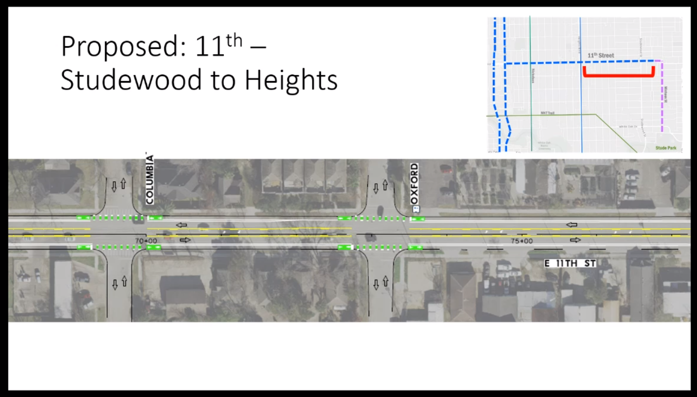
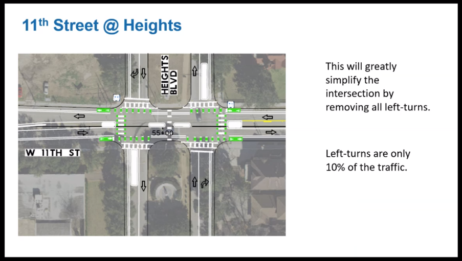
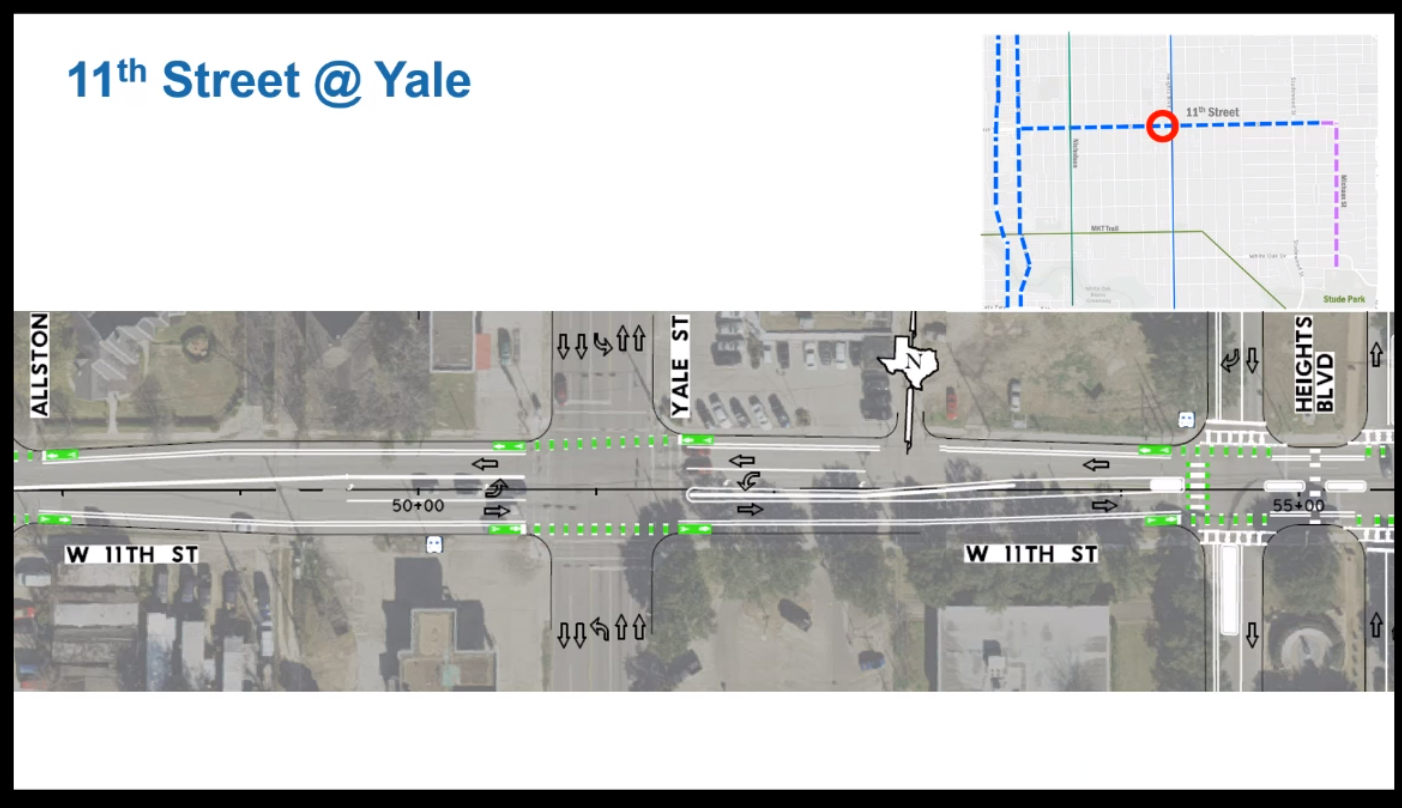
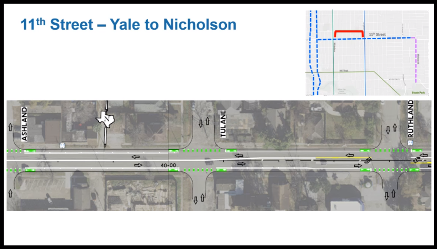
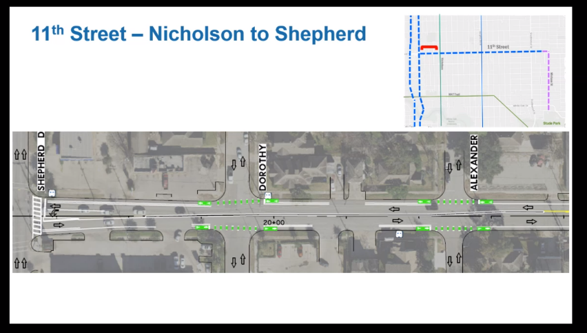
We have an update on the 11th Street Project after the City’s presentation on December 16th (which we advertised via social media). For those who don’t know, the City plans to implement a “road diet” on 11th Street between Shepherd and Michaux: removing one car lane, converting the middle lane to a turning lane (like on Studewood) for most of the road, and adding separated bike lanes. The general idea is to reduce car speed, while maintaining traffic volume, and add infrastructure to make it safer for people walking in biking in the area. The City is currently at 30% design phase and hopes to start construction this coming Summer.
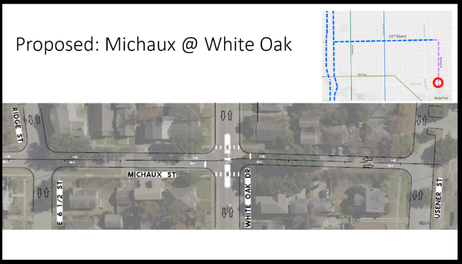
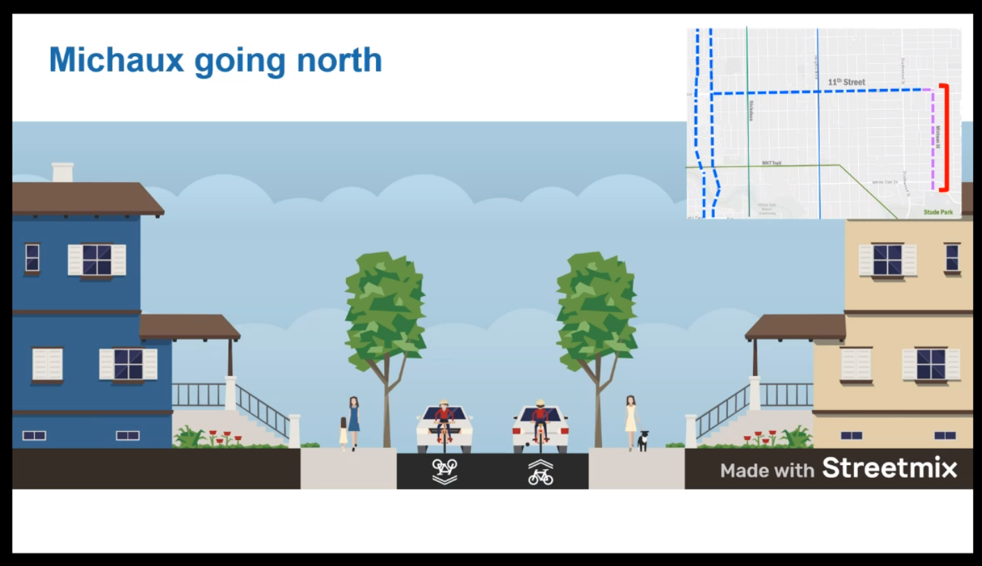
Two particular points of interest for our neighborhood. The first is the location and design of protected crosswalks on 11th Street, such as around Hogg Middle School. The second relates to sections of the project inside our neighborhood. The Houston Bike Plan includes Michaux as a bike thoroughfare to connect 11th Street to the White Oak Bayou Trail. As part of the 11th Street Project, the City plans to (i) add bike signage on Michaux and (ii) install a pedestrian/bike island refuge at Michaux and White Oak.
There are trade-offs for all of these projects. I’m in communication with the City, and would like to get a sense for what our neighbors think about these two points in particular. To be clear, we are likely past the “no go” stage; the project is almost certainly happening. However, there is opportunity to improve the project and have our voices heard in the final design. If you have comments on how the project could improve—and just not general opposition—or are interested in meeting (virtually) about these issues, please contact me (Brad Snead) at infrastructure@woodland-heights.org.
The meeting presentation can be found here: https://houstonbikeplan.org/planned/11th-street/ (look in the public engagement section). Individual comments and questions can be submitted here: www.letstalkhouston.org/11th-street-bikeway.
Overview of Total Project Area
As always, please email any comments, ideas, and suggestions to infrastructure@woodland-heights.org.-
-Brad Snead, Director of Infrastructure
Infrastructure Corner /
We have some updates on local area projects. Sherry Weesner, president of TIRZ 5 and the Memorial Heights Redevelopment Authority, gave an update at the last meeting of the Greater Heights Super Neighborhood Council on August 18th. The Woodland Heights is part of GHSNC council, with one voting delegate chosen by the WHCA Board (currently Brad Snead).
Here is an overview.
First, the image above is an overview of the TIRZ5 project map, which roughly follows White Oak Bayou, but also reaches along Shepherd/Durham, down Heights Blvd to Buffalo Bayou, and to Memorial Park.
Second, Ms. Weesner gave an overview of completed and ongoing projects that TIRZ 5 was involved in, including the new intersection at Houston Ave and White Oak, and the new trail head at the MKT Trail and Studewood.
Third, she gave an overview of several planned projects along the MKT Trail—along the portion from Heights Blvd to Houston Ave—which are at about 90% design completion, and are planned to start next year. (1) Heights Blvd (between Donovan Park and Heights Mercantile)—installing raised crosswalks and making other safety improvements to slow traffic. (2) White Oak Drive (next to Juiceland/Black Swan)—installing “bulb outs” at the intersection, and perhaps a pedestrian island. (3) Sawyer (next to Target)—redesigning the entire intersection, in conjunction with the developer at the corner, to give the trail priority and to make walking/biking safer. (4) Spring Street—installing raised crosswalks and making other safety improvements.
Fourth, on Heights Blvd South of I-10, they are planning several improvements. They will convert the existing bike lanes into separated bike lanes, and are planning to reconstruct the intersections at Washington Ave and Center St, and connect those lanes to Buffalo Bayou Park. In other words, you should be able to bike safely go from the Heights or White Oak Bayou Trail to the new HEB, and on to Buffalo Bayou Park, on separated bike lanes with priority at the intersections. I believe this project is also at the 90% design stage.
Fifth, they are at 60% design stage on a new connection from the White Oak Bayou/MKT Trails to Memorial Park via a CenterPoint utility corridor. The picture on the right is a little hard to see. But the trail currently ends in the Cottage Grove neighborhood, and you have to zig zag through neighborhoods and across I-10 to get to Memorial Park. This could be a significant connector for the Heights area.
Sixth, she discussed the Shepherd/Durham project, which is expected to start construction in 2022 and take multiple years. There are multiple parts, from different funding sources, but it will eventually stretch between I-10 and 610, as well as South of I-10 between Washington Ave and Memorial Dr. They are also working with Houston Metro, which has a planned Bus Rapid Transit stop planned between Shepherd/Durham South of I-10. Generally, the project will remove a car lane both directions (going from 4 to 3), add a raised bike lane (even with the sidewalk, not the road), lined with trees wherever possible. She said they plan to have two rows of trees along the bike lane where space permits, and one row of trees where space does not permit. The bike lane on Shepherd will be on the East side, and will include “floating” Metro bus stops, similar to what is being installed on Cavalcade. The bike lane on Durham will be on the East side as well because of limited right of way. She also explained that they engaged two engineering firms, both of which concluded that the congestion on Shepherd/Durham is not from amount of car lanes, but from the design of the turns. This project should alleviate that congestion while making it safer for other road users.
Seventh, she mentioned several other projects they are assisting with, in conjunction with the Montrose TIRZ and others, putting bike lanes on West Dallas and Dunleavy, adding connections in the area South of Buffalo Bayou between Shepherd and Waugh
Finally, she discussed a question we raised about TIRZ5’s interest in working with neighborhoods to do small projects. She said TIRZ5 usually gets involved in big projects, but likes to take 1 to 2 small projects a year that can be done quickly. They would like to work with neighborhoods as well, if we can find funding for half or so (and she mentioned other potential sources of funds and grants). The WHCA Board will discuss this, and would like input from the neighborhood, on what types of projects we’d like to see to help us connect to these other projects. For example, we could use this to create a bike/pedestrian crossing at White Oak Dr from our neighborhood so we can access the bayou trails more safely.
So there are a lot of things in the works for the coming years. Please email any comments, ideas, and suggestions to infrastructure@woodland-heights.org.
Brad Snead
Director of Infrastructure
Bye Bye Bridge: Old Wooden Bridge on Stude Park Trail To Be Removed. /
This just in regarding an old portion of the trail at Stude Park. The bridge in question is the small wooden foot bridge close to the bayou. It’s been is disrepair for years. It gets very slippery when wet. It also suffers flooding events very poorly.
Good morning,
Houston Parks Board continues making progress on improving the White Oak Bayou Greenway for all trail users. We sincerely appreciate your continued support and would like to share an important update with you.
In an effort to ensure everyone is using safe and well-maintained trails along the bayous, Houston Parks Board will be demolishing an old and crumbled asphalt trail along White Oak Bayou between Stude Park and White Oak Drive. Part of the trail demolition includes a wooden pedestrian bridge south of Thelma Drive and White Oak Drive. Click here to view a map of the demolition area.
Work will begin on the trail and bridge demolition starting Monday, March 16, and is expected to potentially last through March 20, depending on weather, from 7 a.m. to 5 p.m.
Our contractor for this project is L.N. McKean, Inc., who has performed other successful demolition and trail work for our organization.
After work is complete, the trail area will be returned to grass. Trail users can continue to use the White Oak Bayou Greenway Trail (the primary trail for this bayou) that is located near the top of the bayou’s bank along White Oak Bayou Drive.
If you have any questions about this work, feel free to email or call me at the contact information below. Please also share this information with anyone else you think may be interested.
Want to know more?
To learn more about our nonprofit organization and how we create, improve, protect and advocate for parks for everyone, visit www.houstonparksboard.org and click “About Us.”
To explore an interactive map of our other projects, visit www.houstonparksboard.org, and click on our Interactive Map.
Thank you,
Lisa Kasianowitz
Outreach Manager
Houston Parks Board
lisa@houstonparksboard.org
300 North Post Oak Lane
Houston, TX 77024
P: 713-942-8500 X14
F: 713-942-7664
11th Street Project Update /
The following message was recently received, offering the status of the 11th Street bike lane project that was discussed at the WHCA General Meeting in March 2019.
Hello,
We’re pleased to announce that the 11th Street safety project is proceeding into the design phase. Many thanks to all who participated in meetings and provided input so far.
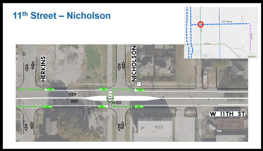
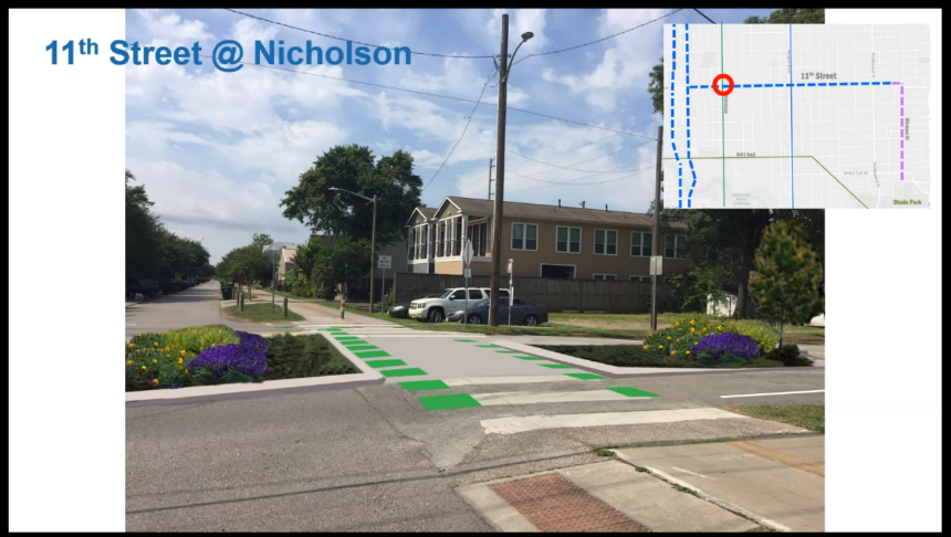
This project will implement safety improvements on 11th Street between Shepherd and Michaux. The new street configuration will consist of 1 vehicle lane and 1 bike lane in each direction with a center lane for making left turns. A pedestrian island will be constructed at the Nicholson Street hike and bike path, to make it safer for people walking and biking across 11th street, and additional pedestrian island locations are being considered as well.
We are excited to bring these roadway improvements to the community, and we are convinced the new configuration with be safer, more efficient and enjoyable for all road users. Construction is estimated to start in Fall 2020 and we will continue to monitor the corridor’s traffic and safety performance after installation.
Your feedback has been integral to this project and it will remain that way during the next three months of the design phase. We look forward to continuing the dialog.
Please follow this link to find out more about the project.
Lauren Grove
Transportation Planner
City of Houston Planning & Development Department
611 Walker Street, 6th Floor
Houston, TX 77002
(832) 393-6550
Lauren.Grove@houstontx.gov
New TxDOT Report on I-45: Public Comment Open Through 1/10/20 /
The following is excerpted from the District H Weekly News on 12/19/2019.
“Learn about the biggest takeaways for the Preferred Alternative I-45 design based on TxDOT's newly updated draft of the Community Impacts Assessment Technical Report by visiting this link. Be sure to respond to TxDOT during the public comment period by 1/10/19. Read Council Member Cisneros' letter to TxDOT requesting an extension of the deadline for public comment on the new draft here.”
Woodland Park's Replica Trolly is Moving On /
Dear Woodland Park and FWP supporters/volunteers,
We are disappointed to report that our remarkable trolley replica has deteriorated beyond repair and will be scheduled for demolition in the next four - six weeks. Even though it was built with pressure treated wood and thoroughly primed and painted, the elements have not been kind. It has also experienced heavy use since its installation (which we have been delighted to see), and this has accelerated its deterioration.
So if you and your children want to enjoy it one more time be sure to do so before the end of November. We plan to save and display the trolley sign along with an early picture of it in an FWP display case that we are in the process of creating. Details will follow.
The good news is we are in discussions with Firefly Field sculptor Dylan Conner to create a woodland-creature playscape that will permanently reside in the playground space that is being vacated with the removal of the trolley. We will keep you informed!
We may need the community’s financial support to make the new addition a reality. As the details of the trolley replacement come into focus we may see a need to launch a fundraising program to cover the cost of the creation and installation of the new structure. So stay tuned.
We are eternally grateful to each and every one of you for your longstanding and ongoing support of our efforts to make the park more enjoyable. We couldn’t have achieved what we have without all of you helping us.
With gratitude,
The Friends of Woodland Park Board of Directors
TXDOT Survey On The I45 Project /
A few days ago this arrived from TXDOT:
We Want Your Feedback: Take the North Houston Highway Improvement Project Survey
Hello Interested Stakeholders,
Please click on the link below to take this short survey about the I-45/North Houston Highway Improvement Project (NHHIP).* This survey is intended to gather feedback on potential actions TxDOT could take in order to lessen impacts on the communities affected by the proposed highway project.
The survey is intentionally short, only seven questions long and should only take a few minutes to complete. Although the survey is brief the information it provides is critical to helping TxDOT improve the NHHIP. Thank you in advance for your feedback. We look forward to hearing from you. Please complete the survey by Sept. 20, 2019.
*More details about the survey...
TxDOT's NHHIP environmental studies identify and quantify potential natural, human and social environmental effects of the proposed transportation improvements. Adverse impacts that cannot be avoided must be adequately mitigated. Accordingly, TxDOT is required to compensate for or replace lost resources. This survey will help us evaluate currently considered mitigation strategies and potentially identify additional options.
For details about the I-45/North Houston Highway Improvement Project, please visit our website at www.ih45northandmore.com.
New WHCA Battery Recycling Effort /
WHCA Secretary Alaina Hebert is leading a new effort to encourage the proper recycling of batteries and consumer electronics items with batteries inside. Following the guidelines offered at Call2Recycle.org, items will be collected at WHCA General Meetings, like one planned for September 10th. The General Meetings are not only an opportunity to engage in the WH community, they’re also your chance to safely dispose of the old batteries & mobile phones cluttering up your junk drawer.
Upcoming I-45 Workshops /
The City and its technical team are gathering input to develop alternative designs and make recommendations to TXDOT and has developed an interactive map that can be accessed here. Please join Council Member Cisneros for the upcoming COH Planning Department Workshops on the IH-45 project. More info here. Additional workshops are being scheduled for late Sept./early Oct. (TBD).
Tuesday, 8/13/19, 6 pm - 7:30 pm, Optional intro at 5:40 pm
Harris County Dept. of Education, 6300 Irvington Blvd.
Accessible by METRO 79
Focus on Segment 2 & 3-North (I-610 to I-10 & I-10 to US-59)
Thursday, 8/15/19, 6 - 7:30 pm, Optional intro at 5:40 pm
Aldine Ninth Grade School, 10650 North Freeway
Accessible by METRO 56, 59, 99
Focus on Segment 1-North (Beltway 8 to N. Shepherd)
Saturday, 8/17/19, 10 am - 11:30 am, Optional intro at 9:40 am
Burrus Elementary School, 701 E. 33rd St.
Accessible by METRO 44 & 56
Focus on Segment 1-South (N. Shepherd to I-610)
Talking Trash with Rollout! Houston /
Not long ago someone commented on NextDoor that they were finally able to keep track of the city schedule for yard waste and heavy trash by watching the WHCA calendar right here on our website. This was completely unexpected! I didn’t think that anyone particularly made use of our calendar, except perhaps our own board members. All of our meetings are listed there.
I thought I’d share my technique for staying on top of the city’s rather confusing trash collection schedule; the Rollout! Houston app. A free smart phone app Rollout is available for both Apple and Android phones, also iPads.
Once installed you enter your zip code or allow the app to determine your location. It looks up the SWM schedule for that location, presenting it with a minimum of clutter or fuss. It’s dramatically simpler than using the COH website. You can instantly know what’s being collected this week, or to lookup the next time heavy trash or yard waste is being picked up.
Rollout! was created as part of a City of Houston Hackathon by Kenton Gray (@kentonue). Joel Cook helped with the design. Its creation dates back to when Annise Parker was mayor. I have found it to be a very reliable way to know when the trucks will be rolling through Woodland Heights.
If you have community events that you’d like added to our calendar, please email the details to communications@woodland-heights.org.
Infrastructure Corner /
The WHCA board would like to start a new feature providing periodic updates of infrastructure-related issues, both big and small, happening in and around the neighborhood. Infrastructure projects require both vision and funding. So we want to keep everyone informed of, not only what is going on, but how those projects are being funded. We’d also like to use this feature to invite feedback on infrastructure projects that you would like to see to improve the safety and enjoyment of our neighborhood. Email us at infrastructure@woodland-heights.org.
So what’s going on? Here are a few things . . .
Houston Ave & White Oak Intersection Nears Completion
If you haven’t seen it yet, the construction is almost finished at the intersection of Houston Ave and White Oak. The City removed the “slip road” connecting White Oak to Houston Ave, widened the sidewalks connecting Woodland Park to the White Oak Bayou Trail, and generally improved the pedestrian and cyclist infrastructure to make the intersection safer for all road users. There is even some green “kermit” striping for a bike lane. And, in case you were wondering, the clock tower is back in.
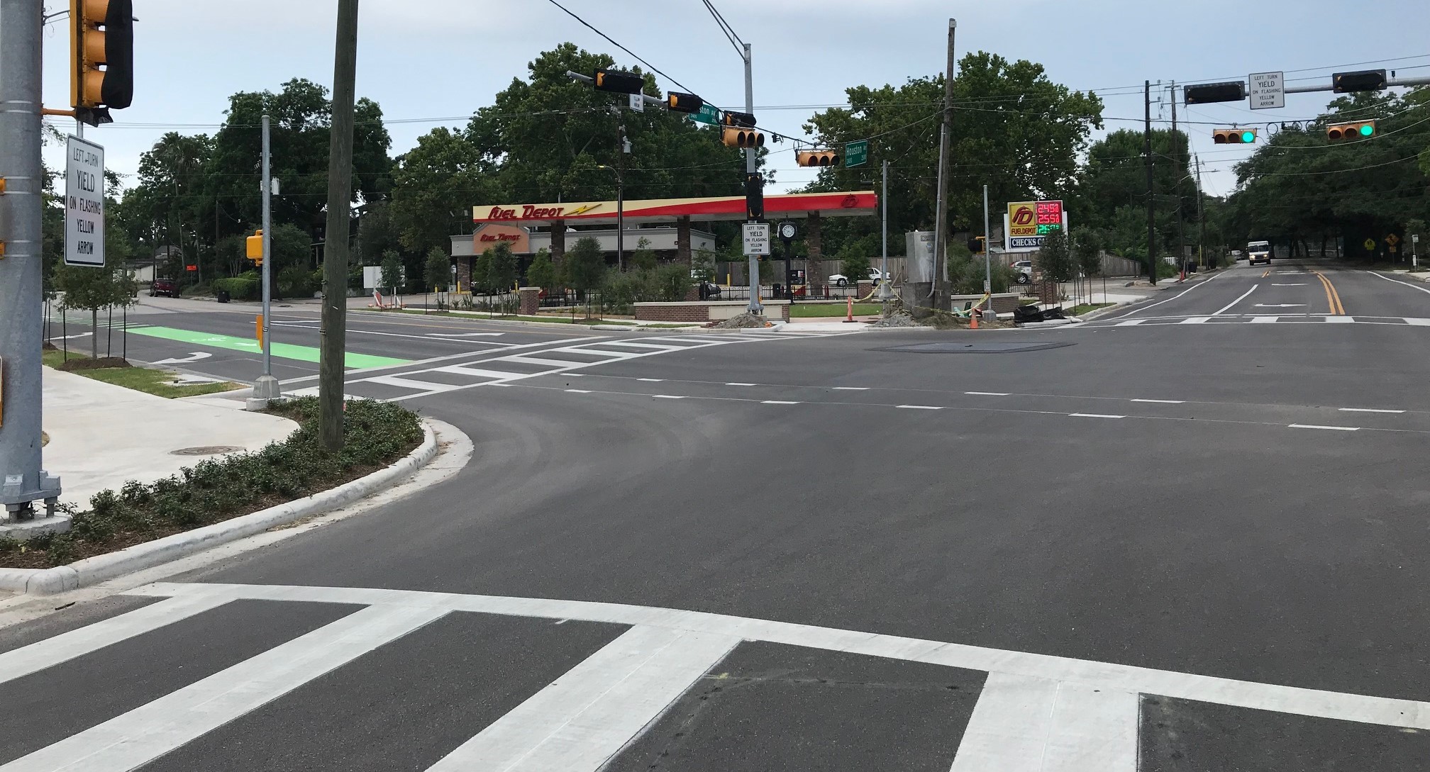
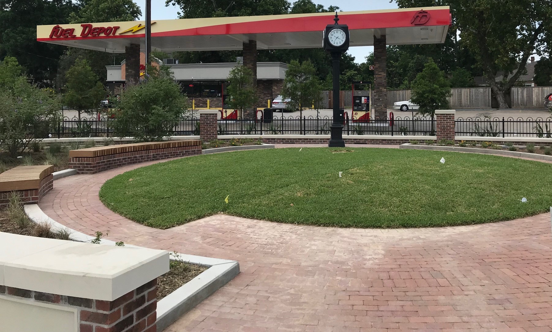
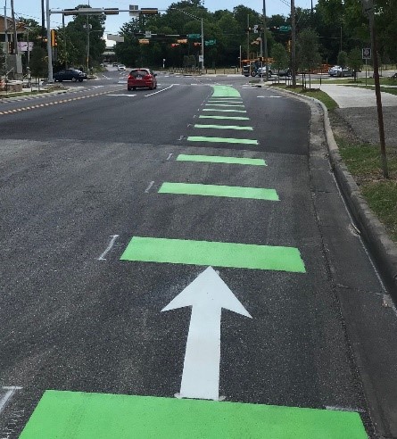
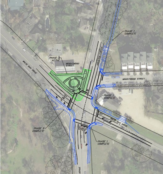
How was this project funded? It was primarily a combination of funds from Tax Increment Reinvestment Zone # 5—or TIRZ 5—and the Greater Northside Management District. For those who don’t know, a “TIRZ” is a political entity in the City limits that retains a portion of property taxes within its district. TIRZ 5 is called “Memorial Heights,” which primarily covers areas surrounding Buffalo Bayou and White Oak Bayou. It does not cover our neighborhood, but it comes close. On the other hand, the Greater Northside Management District covers our neighborhood and most of the Heights East of Yale and South of North Main. It’s funded by a property tax on local commercial businesses.
You can find more information on TIRZ 5 at https://www.houstontx.gov/ecodev/tirz/5.html and on the Greater Northside Management District at http://www.greaternorthsidedistrict.org/home.shtml.
Road Diet and Bike Lane on Houston Ave (White Oak to Spring Street)
Remember the temporary bike lane on Houston Ave during recent construction to I-45? Thanks to City Council Member Karla Cisneros, that bike lane has been made permanent. She used funds from City Council District H to reduce the lanes on Houston Ave between White Oak and Spring Street from four to two (i.e., a “road diet”), and to install protected bike lanes on both sides of the street. This can be a key “North/South” connector between the two bayou trails. They call the barriers “armadillos.”
You can find more information about both of these projects from a local blogger: http://houstreets.com/2019/06/03/houston-ave-white-oak-dr-redesign-complete/
More B-Cycle Stations
On Wednesday, May 30, 2019, Houston B-Cycle installed two new stations in the Heights. The first is at 11th Street and Heights Blvd (Heights Central Station) and the second is at 7th and Yale (Heights Mercantile). That brings the total number of stations in the Heights to five (Woodland Park, Stude Park, Bobcat Teddy’s, Heights Central Station, and Heights Mercantile), with a number of additional stations just outside of our area.
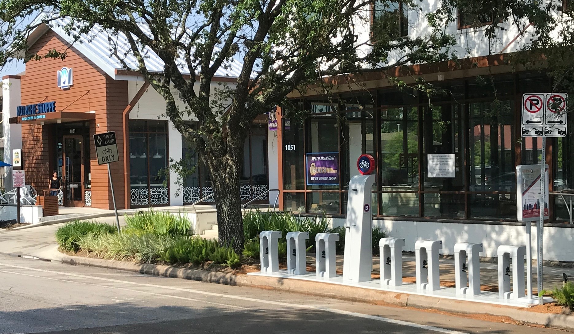
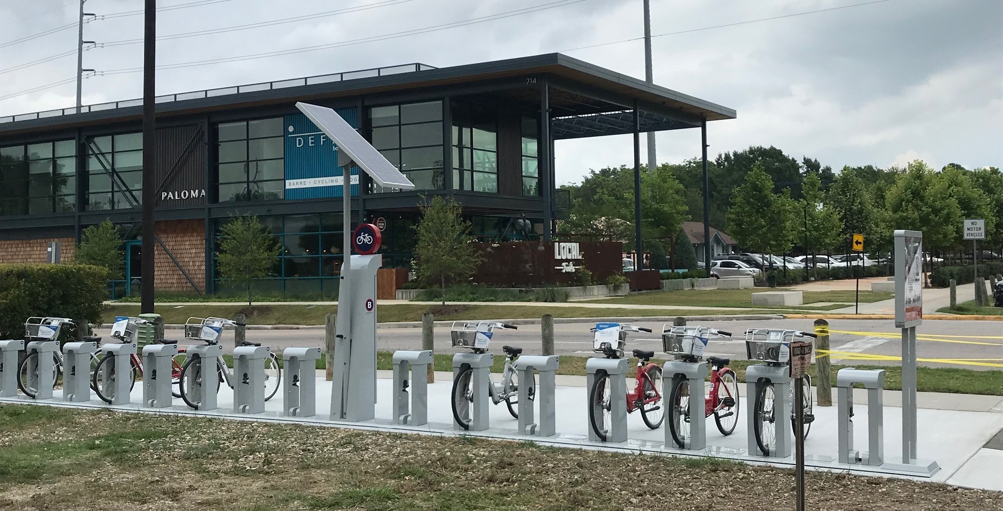
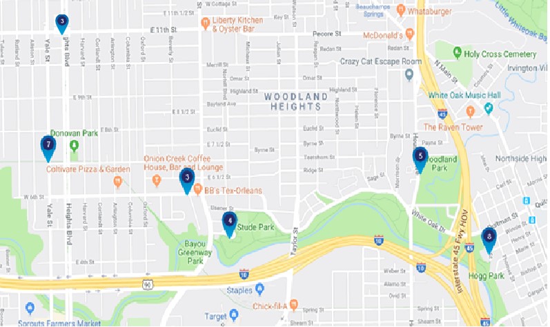
You may ask why at these locations? Because these developers helped fund the stations. Houston B-Cycle is currently operating on a large grant that requires local funding for 50% of each station, which ranges from $10-20k. You can find the full map B-Cycle station map here: http://houston.bcycle.com/station-map. Where else would you like to see a B-Cycle station in our neighborhood?
That’s it for now. We’d love to hear from you about infrastructure projects you’d like to see in and around the neighborhood. And please let us know of current or future projects you hear about. Again, email us at infrastructure@woodland-heights.org.
Brad Snead
WHCA Director of Infrastructure
About the 11th Street "Road Diet" /
Did you miss the meeting at Hogg Middle School last night regarding 11th Street? Here's the latest!
Ian Hlavacek and Lauren Grove presented a proposal to reconfigure 11th street between Shepherd and Michaux. The proposal, called a 'Road Diet', has been shown to:
a) accommodate existing and future traffic
b) will not divert traffic to side streets
c) reduce traffic speed
d) decrease unsafe driving maneuvers like weaving
e) introduce a safe east-west bike route
f) improve safety for people walking along and crossing 11th
g) increase safety for people using the Nicholson Trail
h) serve cross streets and driveways effectively
i) could increase travel time for drivers up to 30 seconds
Here's an article with a video that helps demonstrate how road diets work: https://www.vox.com/2018/7/25/17593344/road-diets-lane-conversion-traffic-calming-explained-video
Note that this configuration will also allow for the installation of 'pedestrian refuges,' or islands, which will make pedestrian crossings easier and safer. The City has received many calls and emails over the years from our community advocating for a safer crossing at the Nicholson Trail crossing at 11th. This configuration will make these safer crossings available at other spots as well, especially those that serve our kids on foot and bikes going to school.
These refuges are also planned for Studewood. This article illustrates how pedestrian refuges work: http://pedbikesafe.org/PEDSAFE/countermeasures_detail.cfm?CM_NUM=19
Looking around our own neighborhood we have at least a few examples of four lanes reducing to two or three:
Studemont to Studewood as you travel north
Cavalcade to 20th
Waugh to Heights
To voice your comments:
ian.hlavacek@houstontx.gov
lauren.grove@houstontx.gov
jennifer.ostlind@houstontx.gov
Houston Bikeways 11th Street Public Meeting #2 /
Wednesday, May 8 from 6:30-8pm at Hogg Middle School is the City of Houston’s second public meeting to discuss proposed street safety improvements along 11th street between Shepherd St. and Michaux St. We encourage everyone to attend.
The Planning Department and Houston Public Works have decided to table proposed bikeways on Pecore and the western section of 11th from Shepherd to T.C. Jester/White Oak Bayou. We will discuss this decision in further detail at the May 8th meeting.
We will present an overview of the 11th Street proposal between Shepherd and Michaux, focusing on detailed information and design concepts for the corridor and intersections. We may also discuss alternative routes to Pecore – where no changes to traffic patterns or parking are proposed.
Pecore Street Houston Bike Plan /
Woodland Heights Neighbors—
As you may know, the City of Houston (COH) is modifying certain major connector streets around our neighborhood to: 1. increase vehicular, bike, and pedestrian safety; 2. increase connectivity; and 3. improve traffic flow.
As a part of the plan, COH has proposed a major update to 11th Street, extending from Timbergrove to the point where 11th meets Pecore at Michaux. The initial COH plan included Pecore too—removing all street parking and adding bike lanes on both sides from Michaux to Houston Avenue. However, COH has put the Pecore section of the plan on hold for now (but is still planning to implement the 11th Street section). We want to explain why.
The initial plan was to for 11th/Pecore to act as a major cross-Heights bike connector from Timbergrove to the Near Northside. Along 11th, bike lanes will be added to both sides, a turn lane in the center, and four lanes of traffic reduced to two. Refuge islands will also be added at major pedestrian/bike crossings, such as Nicholson. COH studies show that this will still accommodate the volume of traffic while increasing safety for pedestrians, bikers, and cars. Initially, the same modification was proposed for Pecore all the way to Houston Avenue, minus the center turn lane and removing all street parking.
After the plan was presented by COH planners at our general meeting on Tuesday, March 19, the WHCA Board heard from a number of neighbors who were concerned about the removal of parking on Pecore (as well as several who supported the plan). On Friday April 19, we sent the following letter to Mayor Turner, several city council members, and the COH planners in charge of the project:
“Dear Mayor Turner,
I am writing on behalf of the Woodland Heights Civic Association Board of Directors. We wanted to commend you for your efforts to make Houston a city which is safer and more friendly to cyclists. Although it is not in our Association footprint, we want to express our personal commendations for your effort to make the intersection at 11th Street and Nicholson Street safer for cyclists, pedestrians and drivers.
However, we are expressing our concern regarding the plan to remove all the street parking from Pecore Street. As you likely know, our Association is dominated by historic bungalows which commonly do not have wide driveways and two-car garages. By removing all the street parking from Pecore, the Associations residents living on that street would be put under undue hardship.”
Three hours later, we were notified by COH that they were “tabling the Pecore proposal…due to the many concerns [they] heard.” As an alternative, the east end of the 11th Street bike lanes would connect to a north-south bike route on Michaux, ending at Stude Park and the White Oak bike trail. This segment would not include dedicated bike lanes, but would add improved signage along the route and improve the intersection of Michaux and White Oak.
Subsequently, we heard from COH planners that they tabled the Pecore section not only because of concerns from residents, but because they don’t have an existing safe bike connection on the east side to connect to (presumably where Pecore meets Houston Ave). In the future, COH intends to pursue high-comfort bike lanes on Main Street. They may restart the conversation regarding Pecore at that time.
COH will have another public meeting at 7 pm on May 8 at Hogg Middle School to discuss 11th Street, Pecore, Michaux, and other future plans. We encourage Woodland Heights neighbors to attend.
As always, feel free to contact the WHCA Board if you have any questions or concerns.
Thanks,
Matt Johnson
Director of Infrastructure
WHCA Board of Directors
Closures on 45 this weekend /
IH 45 North Freeway Northbound Frontage Road between the IH 610 N. Loop and E. Tidwell: Alternate Lane(s) Closed Continuously between 8:00 AM and 3:00 PM on Friday, 04.12.19 and again between 8:00 PM on Friday, 04.12.19 and 5:00 AM on Monday, 04.15.19. At least one lane will remain open at all times.
IH 45 North Freeway Northbound Exit Ramp to Crosstimbers: Total Closure between 8:00 AM and 3:00 PM on Friday, 04.12.19 and again between 8:00 PM on Friday, 04.12.19 and 5:00 AM on Monday, 04.15.19. Detour via the IH 45 Northbound Main lanes to the Airline Dr. Exit. Exit Ramp; then follow the IH 45 Northbound Frontage Rd. to the U-Turn at Airline. Follow the U-Turn at Airline to the IH 45 Southbound Frontage Rd. Follow the IH 45 Southbound Frontage Rd. to Crosstimbers St. Please note that this ramp closure will alternate with the Airline Exit Ramp closure and that only one ramp will be closed at a time.
IH 45 North Freeway Northbound Exit Ramp to Airline Dr.: Total Closure between 8:00 AM and 3:00 PM on Friday, 04.12.19 and again between 8:00 PM on Friday, 04.12.19 and 5:00 AM on Monday, 04.15.19. Detour via the IH 45 Northbound Mainlanes to the Tidwell Rd. Exit Ramp; then follow the IH 45 Northbound Frontage Rd. to the U-Turn at E. Tidwell. Follow the U-Turn at E. Tidwell to the IH 45 Southbound Frontage Rd.. Follow the IH 45 Southbound Frontage Rd. to Airline. Please note that this ramp closure will alternate with the Crosstimbers Exit Ramp closure and that only one ramp will be closed at a time.
IH 45 North Freeway Southbound Frontage Road. between E. Tidwell and the IH 610 N. Loop: Alternate Lane(s) Closed Continuously between 8:00 AM and 3:00 PM on Friday, 04.12.19 and again between 8:00 PM on Friday, 04.12.19 and 5:00 AM on Monday, 04.15.19. At least one lane will remain open at all times.
IH 45 North Freeway Southbound Entrance Ramp from Airline: Total Closure between 8:00 AM and 3:00 PM on Friday, 04.12.19 and again between 8:00 PM on Friday, 04.12.19 and 5:00 AM on Monday, 04.15.19. Detour via the IH 45 Southbound frontage road to the Crosstimbers Entrance Ramp. Please note that this ramp closure will alternate with the Crosstimbers Exit Ramp, the Exit 52A Exit Ramp and the Crosstimbers entrance ramp closures and that only one ramp will be closed at a time.
IH 45 North Freeway Southbound Exit Ramp to Crosstimbers: Total Closure between 8:00 AM and 3:00 PM on Friday, 04.12.19 and again between 8:00 PM on Friday, 04.12.19 and 5:00 AM on Monday, 04.15.19. Detour via the IH 45 Southbound Main lanes to the Southbound Frontage Road (Exit 52A) Exit Ramp; follow the IH 45 Southbound Frontage Rd. to the U-Turn. Follow the U-Turn at end of the frontage road to the IH 45 Northbound Frontage Rd. Follow the IH 45 Northbound Frontage Rd. to Crosstimbers. Please note that this ramp closure will alternate with the Southbound Entrance Ramp from Airline and that only one ramp will be closed at a time.
IH 45 North Freeway Southbound Exit Ramp to the IH 45 Southbound Frontage Rd. (Exit 52A): Total Closure between 8:00 AM and 3:00 PM on Friday, 04.12.19 and again between 8:00 PM on Friday, 04.12.19 and 5:00 AM on Monday, 04.15.19. Detour via the IH 45 Southbound Main lanes to the W. Cavalcade Exit Ramp; then follow the IH 45 Southbound Frontage Rd. to the U-Turn at W. Cavalcade. Follow the U-Turn to the IH 45 Northbound Frontage Rd. Follow the IH 45 Northbound Frontage Rd. to the next northbound entrance ramp. Follow the IH 45 Northbound Mainlanes to the E. Crosstimbers Exit. Turn Left, (West) on Crosstimbers and then turn Left, (South) on the IH 45 Southbound Frontage Rd.
Please note that this ramp closure will alternate with the Southbound Exit Ramp to Crosstimbers closure and that only one ramp will be closed at a time.IH 45 North Freeway Southbound Entrance Ramp from Crosstimbers: Total Closure between 8:00 AM and 3:00 PM on Friday, 04.12.19 and again between 8:00 PM on Friday, 04.12.19 and 5:00 AM on Monday, 04.15.19. . Detour via the IH 45 Southbound Frontage Rd. to the U-Turn at end of frontage road; Follow the U-Turn to the IH 45 Northbound Frontage Rd. Follow the IH 45 Northbound Frontage Rd. to Airline. Follow the U-Turn at Airline to the IH 45 Southbound Frontage Rd. Follow the IH 45 Southbound Frontage Rd to the entrance ramp from Airline. Please note that this ramp closure will alternate with the Southbound Entrance Ramp from Crosstimbers and that only one ramp will be closed at a time.
COH Presentation on Heights Area Street Safety Improvements /
The WHCA General Meeting on March 19th included a presentation about plans to change the configuration of 11th Street, Studewood and Pecore. This presentation helped to inspire an impressive turnout (62!) for the meeting, which was held in the library at Travis Elementary School. Since there are no doubt many others who would be interested in the details of this project, we recorded the meeting, to make it available here. The slides used in the presentation are also available in PDF format.
The decision to record this meeting was very last minute. The event was shot with a single camera, mostly focussed on the presenter. The video offered here was edited only to add the slides and whatever B-roll shots I could capture using my phone, once the Q&A was underway. It was not edited for content in any way.


